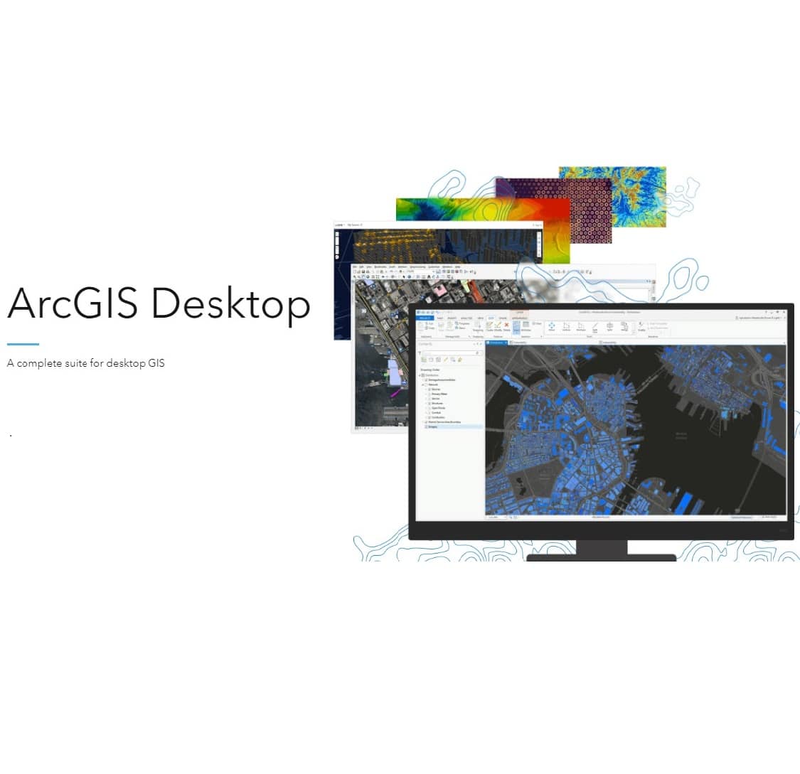
Esri ArcGIS Desktop 10.8.2 Lifetime Activation for Windows
204 Item Sold
Lifetime Activation
For Windows
Comes with activation files
Esri ArcGIS Desktop 10.8.2 – Lifetime Activation for Windows
Transform your geographic data analysis and mapping capabilities with Esri ArcGIS Desktop 10.8.2, the industry-leading Geographic Information System (GIS) software that professionals worldwide trust for complex spatial analysis and stunning cartographic visualization. This lifetime activation provides you with a permanent license that eliminates recurring subscription fees, making it the smartest investment for your mapping and analysis needs.
Esri ArcGIS Desktop 10.8.2 + Extensions:
-MXD Doctor
-ArcGIS document defragmenter
-ArcScene
-ArcMap
-ArcGlobe
-ArcCatalog
-Module Docs
-IDLE Python GUI
-Python Command line
Why Choose ArcGIS Desktop 10.8.2?
ArcGIS Desktop isn’t just mapping software—it’s a complete spatial analysis powerhouse that turns raw geographic data into actionable insights. Whether you’re an urban planner designing smarter cities, an environmental scientist tracking climate patterns, or a business analyst optimizing delivery routes, this software provides the tools you need to make data-driven decisions with confidence.
With our digital download and instant delivery, you’ll have access to your software within minutes of purchase. No waiting for physical shipments, no delays—just immediate access to the full version of this powerful GIS platform.
Complete Feature Overview
Advanced Mapping and Visualization Tools
ArcGIS Desktop 10.8.2 excels at transforming complex datasets into clear, compelling visual stories. The software includes sophisticated cartographic tools that let you create publication-quality maps with professional styling options. You can customize colors, symbols, labels, and layouts to match your organization’s branding or specific project requirements.
The 3D visualization capabilities allow you to explore terrain models, urban environments, and environmental data from multiple perspectives. This feature proves invaluable for presentations, stakeholder meetings, and detailed analysis where understanding spatial relationships is crucial.
Comprehensive Spatial Analysis
The software’s analysis tools help you uncover patterns and relationships within your geographic data. Perform proximity analysis to understand how different features relate spatially, conduct overlay operations to combine multiple data layers, and use statistical tools to identify trends and correlations.
Network analysis capabilities enable you to solve complex routing problems, optimize service areas, and analyze transportation networks. These tools are essential for logistics companies, emergency services, and any organization that needs to understand movement patterns and accessibility.
Data Management and Integration
ArcGIS Desktop 10.8.2 handles virtually any data format you might encounter. Import data from GPS devices, satellite imagery, CAD files, databases, spreadsheets, and web services. The software’s geodatabase technology ensures your data remains organized, accessible, and maintains its spatial integrity.
The built-in data validation tools help maintain data quality by identifying and correcting inconsistencies, ensuring your analysis results are reliable and accurate.
Geoprocessing and Automation
Streamline repetitive tasks with the powerful geoprocessing framework. Create custom workflows using ModelBuilder’s drag-and-drop interface, or write Python scripts for more advanced automation. These capabilities save countless hours when working with large datasets or performing routine analysis tasks.
The batch processing features allow you to apply the same operations to multiple datasets simultaneously, dramatically improving efficiency for large-scale projects.
Professional Cartographic Output
Generate maps that meet the highest professional standards with advanced layout tools. Control every aspect of your map’s appearance, from precise text placement to custom legends and scale bars. The software supports high-resolution printing and export formats suitable for both digital distribution and large-format printing.
What’s Included in Your Purchase
Complete Software Suite
Your full version includes all three core applications: ArcMap for desktop mapping and analysis, ArcCatalog for data management and organization, and ArcToolbox for geoprocessing operations. This comprehensive toolkit provides everything needed for professional GIS work.
Extensions and Add-ons
Access powerful extensions that expand the software’s capabilities, including Spatial Analyst for advanced raster analysis, Network Analyst for routing and logistics, and 3D Analyst for three-dimensional visualization and analysis.
Sample Data and Templates
Get started immediately with included sample datasets and map templates. These resources help you learn the software’s capabilities while providing starting points for your own projects.
System Requirements and Compatibility
For Windows 10 and 11, ArcGIS Desktop 10.8.2 runs smoothly on modern hardware configurations. The software is optimized for both single-user workstations and enterprise environments, scaling effectively based on your system’s capabilities.
Minimum system requirements include 4GB RAM (8GB recommended), 6GB available hard disk space, and a dedicated graphics card for optimal 3D performance. The software supports both 32-bit and 64-bit processing, automatically utilizing your system’s full potential.
Industry Applications
Urban Planning and Development
City planners use ArcGIS Desktop to analyze population growth patterns, plan infrastructure development, and assess environmental impacts. The software’s modeling capabilities help predict how proposed changes will affect traffic flow, utility demand, and quality of life.
Environmental Management
Environmental scientists rely on ArcGIS Desktop for habitat analysis, pollution monitoring, and conservation planning. The software’s ability to integrate satellite imagery with field data provides comprehensive insights into environmental changes over time.
Business Intelligence and Market Analysis
Retailers and service providers use location intelligence to optimize store locations, understand customer demographics, and plan marketing campaigns. The software’s demographic analysis tools reveal market opportunities and competitive advantages.
Emergency Management and Public Safety
First responders and emergency managers use ArcGIS Desktop to plan evacuation routes, assess disaster impacts, and coordinate response efforts. The software’s real-time data integration capabilities support critical decision-making during emergencies.
Agriculture and Natural Resources
Farmers and resource managers use precision agriculture tools to optimize crop yields, monitor soil conditions, and manage water resources. The software’s integration with GPS and sensor data enables data-driven farming practices.
Technical Advantages
Performance and Reliability
ArcGIS Desktop 10.8.2 delivers consistent performance even with large datasets. The software’s memory management and processing optimizations ensure smooth operation during intensive analysis tasks.
Interoperability
Connect seamlessly with other Esri products and third-party systems. The software supports industry-standard data formats and web services, ensuring compatibility with existing workflows and systems.
Customization Options
Extend the software’s functionality through custom tools, scripts, and add-ins. The comprehensive development framework allows organizations to create specialized solutions that meet unique requirements.
Purchase Benefits and Guarantees
Authentic License Guarantee
Your purchase includes an original, genuine, and legitimate license backed by our authentic license guarantee. We stand behind every sale with complete transparency about licensing terms and conditions.
Money-Back Protection
Shop with confidence knowing your purchase is protected by our comprehensive money-back guarantee. If you’re not completely satisfied with your software or our service, we’ll make it right.
Global Licensing
Your license is valid worldwide, providing flexibility for international organizations and remote teams. The global license ensures compliance regardless of where you or your team members are located.
Professional Installation Support
Take advantage of our free assistance to install and activate your software. Our technical team will install it for you remotely if needed, ensuring a smooth setup process that gets you up and running quickly.
Easy installation and activation procedures mean you won’t struggle with complex setup processes. Our streamlined approach gets you working with your new software in minimal time.
Value Proposition
One-Time Investment
Unlike subscription models that create ongoing costs, your lifetime activation represents a one-time payment that provides permanent access to this powerful software. This approach offers significant long-term savings compared to recurring licensing fees.
Best Price Guarantee
We offer competitive pricing that represents exceptional value for professional-grade GIS software. Our trusted store reputation and secure online payment processing ensure a safe, reliable purchasing experience.
Immediate Availability
Buy online and receive instant access through our digital download system. The instant delivery means you can start using your software immediately, without delays or shipping complications.
Getting Started
Purchase Esri ArcGIS Desktop Process
The purchasing process is straightforward and secure. Buy Esri ArcGIS Desktop through our streamlined checkout system that accepts multiple payment methods while maintaining the highest security standards.
Esri ArcGIS Desktop activation Support
Our technical support team assists with Esri ArcGIS Desktop activation procedures, ensuring your software is properly licensed and ready for use. We provide clear instructions and hands-on help when needed.
Learning Resources
Access comprehensive documentation, tutorials, and training materials that help you master the software’s Esri ArcGIS Desktop features. These resources support both beginners and experienced users looking to expand their skills.
Technical Support and Ongoing Assistance
Our commitment to customer success extends beyond the initial purchase. Receive ongoing technical support for installation issues, activation questions, and basic troubleshooting. Our knowledgeable team understands both the software and the real-world challenges users face.
The support includes guidance on optimizing performance for your specific hardware configuration, recommendations for workflow improvements, and assistance with data migration from other GIS platforms.
Version Benefits and Updates
ArcGIS Desktop 10.8.2 represents the last version of the desktop suite before Esri’s transition to their Pro platform, making it a valuable long-term investment for organizations preferring the traditional desktop interface. This version includes years of refinements and stability improvements while maintaining compatibility with existing workflows and extensions.
The software’s mature codebase ensures reliability and predictable performance, crucial factors for organizations depending on GIS analysis for critical decisions.
Security and Compliance
Your software purchase includes security features that protect your data and ensure compliance with organizational IT policies. The software supports user authentication, data encryption, and audit trails that meet enterprise security requirements.
Regular security updates and patches maintain protection against emerging threats while preserving software functionality and performance.
Conclusion
Esri ArcGIS Desktop 10.8.2 with lifetime activation represents an exceptional investment in professional GIS capabilities. The combination of powerful analysis tools, flexible data handling, and professional cartographic output makes this software indispensable for organizations working with geographic data.
Your purchase includes not just the software, but a complete support ecosystem designed to ensure your success. From remote installation assistance to ongoing technical support, we’re committed to helping you maximize the value of your investment.
Don’t let recurring subscription costs drain your budget. Invest in a permanent license that provides long-term value and immediate access to industry-leading GIS capabilities. With our secure online payment processing and instant delivery, you can start transforming your spatial analysis capabilities today.
Take advantage of this opportunity to acquire professional-grade GIS software at an unbeatable value. Your lifetime activation awaits—unlock the power of location intelligence and transform how your organization understands and uses geographic data.


